(Antiquity, 2017)
The Ypres Salient 1914–1918: historical aerial photography and the landscape of war
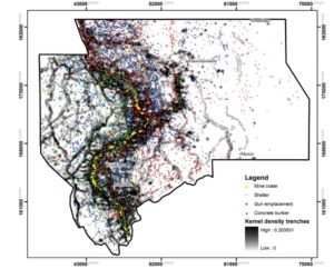
As the centenary commemorations of the Battle of Passchendaele approach, this article is a timely demonstration of how archaeology can provide new insights into the landscape of the Western Front. Assessment of over 9000 aerial photographs taken during the First World War, integrated with other approaches to landscape archaeology, offers a new perspective on the shifting nature of the historic struggle around the town of Ypres in Belgium. The results not only illustrate the changing face of the landscape over that four-year period, but also highlight the potential of aerial photographic records to illuminate hitherto overlooked aspects of landscape heritage.
Reference:
Stichelbaut, B., Gheyle, W., Van Eetvelde, V., Van Meirvenne, Saey, T., M., Note, N., Van den Berghe, H. & Bourgeois, J. (2016). The Ypres Salient 1914–1918: historical aerial photography and the landscape of war. Antiquity, 91 (355), 235-249. doi: 10.15184/aqy.2016.260